Planetary
Coral Reef Foundation Science Report
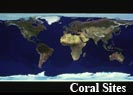
World Cloud Free (NASA - Visible Earth, ESRI)
Excerpted from image metadata:
World Cloud Free represents a true color cloud-free view of the earth produced by mosaicking hundreds of individual 2001 NASA Moderate Resolution Imaging Spectroradiometer (MODIS) satellite images. These satellites orbit the earth at an altitude of 700 km (455 miles). The image has a cell size of 1 kilometer (.386 sq. mi.) at the equator. The image was enhanced with shaded relief imagery derived from the USGS GTOPO30 digital elevation data. ESRI georeferenced these data to a real world coordinate system.